
- calendar_today October 10, 2026
Dangerous Sneaker Waves Threaten Oregon and Washington Coastlines
This weekend, the Pacific Northwest is bracing for significant and fast-arriving weather changes, as sneaker waves are anticipated along the coastline and the region faces its first substantial frost of the season. The National Weather Service (NWS) has issued multiple alerts covering both beach hazards and cold inland temperatures.
NWS Issues Beach Hazards and Sneaker Wave Warnings
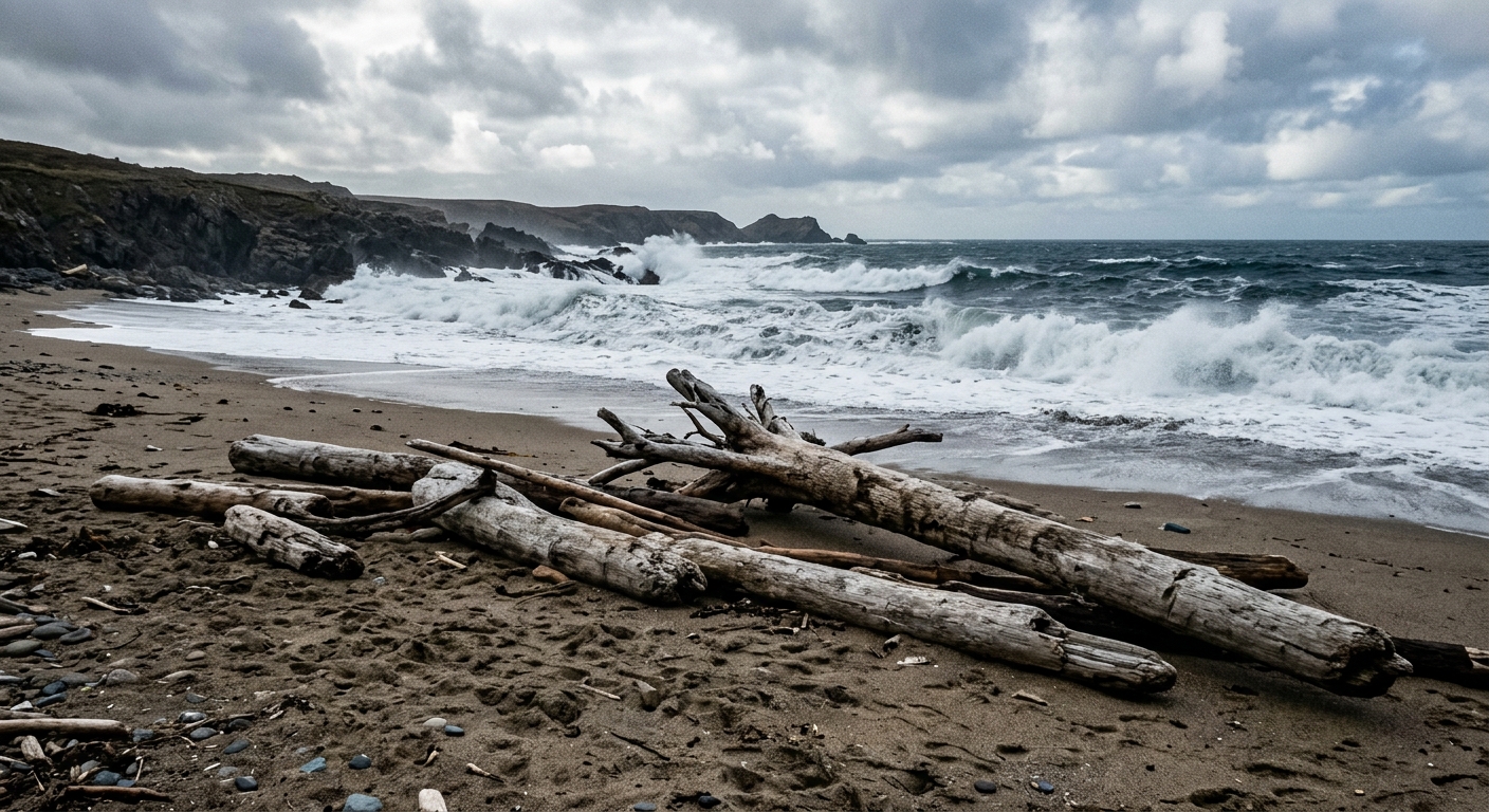
Beachgoers, particularly on the north and south Oregon coast, are being urged to use extra caution on Sunday, October 11, 2026. The NWS has highlighted an enhanced threat of sneaker waves, warning that these powerful waves can surge much farther up the beach than usual, potentially sweeping away unwary visitors. There is also danger from debris: large logs on beaches can be lifted or rolled by sneaker waves, posing severe risks of injury or even death. The NWS advises everyone to steer clear of rocks, logs, and jetties near the waterline and to never turn their back to the ocean while at the beach.
South Coast Sneaker Wave Hazard
Communities including Reedsport, Coos Bay, Bandon, Port Orford, Gold Beach, and Brookings should expect dangerous beach conditions over the weekend. A beach hazards statement is in effect from late Saturday through Monday afternoon. The NWS explains that a west-northwest swell with an unusually long period will reach the southern Oregon coastal waters, resulting in significant wave run up. Swells are anticipated to build through Sunday, peaking at 5 to 6 feet at 19 seconds by the afternoon and evening. The riskiest period for sneaker waves is expected around high tide, noon to 1 p.m. Although these conditions are hazardous, they do not produce the kind of dramatic displays sometimes seen at locations like Shore Acres, which require wave heights of at least 16 feet.
First Hard Freeze: Widespread Frost Advisories Issued
While coastal areas confront wave risks, inland regions throughout Washington and Oregon will feel the effects of the season’s first hard freeze. Frost advisories are in effect from midnight through Sunday morning for many communities, including parts of northwest Oregon and southwest Washington. The affected areas span the North Oregon Coast Range and its lowlands, the Cascade Foothills in Clackamas, Marion, Linn, and Lane counties, as well as the outer southeast Portland metro, Linn County Lowlands, North Clark County Lowlands, and South Washington Cascade Foothills. Residents of Vernonia, Estacada, Mill City, Oakridge, Amboy, Ridgefield, and surrounding locations are likely to see temperatures drop to between 33 and 36 degrees, resulting in frost formation.
Upper Hood River Valley Cold Snap
The Upper Hood River Valley, including Parkdale and Odell, is also under a Frost Advisory from midnight through 9 a.m. Sunday. Lows are forecasted at 33 to 36 degrees with coldest pockets near Parkdale and Dee potentially reaching 32 degrees or below. The NWS notes that frost may damage sensitive vegetation, and recommends gardeners protect plants or move them indoors as a precaution.
Western Washington Valleys Face Multiple Freeze Events
In the foothills and valleys of Pierce, southern King, Thurston, and Lewis counties, two separate Frost Advisories are in place: one from midnight to 8 a.m. Sunday, and the other from midnight Sunday to 8 a.m. Monday. Maple Valley, Enumclaw, Morton, Prairie Ridge, and South Hill can anticipate early morning lows in the 30s, with Monday’s readings potentially dipping to 30–36 degrees. Gardeners and residents are advised to take steps for vegetation protection as colder pockets pose threats to outdoor plants.
Staying Safe During Beach Hazards and Hard Freezes
The NWS and local weather authorities stress the importance of caution both along the coast—where sneaker waves and wave run up present significant risks—and inland, where frost may harm crops and gardens. Beach visitors should remain alert and avoid hazardous spots near the water, especially during high tide. Residents across affected regions are encouraged to cover or bring in vulnerable plants overnight to prevent frost damage.
Source: beachconnection.net.


