- calendar_today June 28, 2026
Oregon faced a powerful bout of oregon weather on June 27, 2026, as severe thunderstorms swept through the region, unleashing heavy rains, vivid lightning, and hazardous conditions that affected several communities across Northwest Oregon.
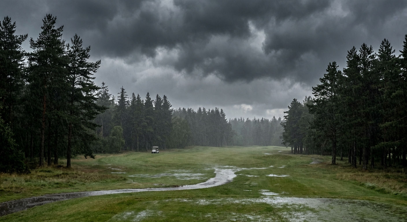
Lightning Strike at Oregon Golf Club Highlights Dangers
One of the most striking incidents occurred at the Oregon Golf Club in West Linn, where a golfer was struck by lightning while taking shelter in his golf cart. Bystanders reported that the man was briefly knocked unconscious. Emergency responders quickly transported him to a Portland burn center. As of Saturday morning, medical staff reported that the golfer was awake and expected to recover—an outcome seen as fortunate given the risks associated with a lightning strike.
Pacific Northwest Thunderstorms Impact Communities
The storms marked one of the more active pacific northwest thunderstorms so far this year, according to local meteorologists. Intense lightning activity was documented in and around Portland, Tualatin, and West Linn, with dramatic bolts observed overhead near the I-5 corridor south of Portland. Residents described the weather’s rapid transformation from calm to extremely turbulent, emphasizing the unpredictability of thunderstorms oregon communities can face during the summer.
Severe Weather Documented by NOAA Satellite Data
Satellite imagery from the NOAA GOES 18 confirmed the presence of storm cells and tracked a sweeping line of severe weather over much of Northwest Oregon from morning through late afternoon. The National Weather Service issued several storm alerts as the system intensified, advising residents to take immediate precautions. Weather experts noted that the rapidly shifting conditions met criteria for weather warnings, especially near high-traffic corridors and open recreational areas.
Molalla Funnel Cloud Prompts Safety Response
Nearby Molalla experienced some of the most dramatic effects of the storms. Witnesses reported seeing a funnel cloud form just outside the city limits, which prompted a brief alert from the national weather service. Fortunately, the funnel cloud did not result in a touchdown, but the incident underscored the seriousness of the weather hazards confronting communities across Oregon. Heavy rain in the area dramatically reduced visibility and forced traffic to slow on major highways, according to local drivers.
Storm Safety and Preparedness Emphasized
Authorities and local officials are advising the public to observe storm safety practices in the aftermath of these severe events. Experts stress the importance of monitoring up-to-date storm alerts and taking cover immediately when thunder or lightning is present. Outdoor recreation enthusiasts, in particular, are being cautioned to avoid exposed locations whenever storm warnings are active. The Oregon weather this week has served as a reminder that summer storms in the region can intensify rapidly and demand careful attention from residents and visitors alike.
Community Resilience and Continued Vigilance
Institutions across Oregon, including local governments, emergency responders, and the National Weather Service, are reinforcing messaging about weather hazards and the protocols for staying safe as unpredictable severe weather events continue. With a forecast that includes more potential storms, residents are reminded to remain alert to both official advisories and direct weather warnings from meteorologists. As Northwest Oregon recovers from this week’s disruption, preparedness and awareness are being prioritized by individuals, families, and businesses throughout the region.